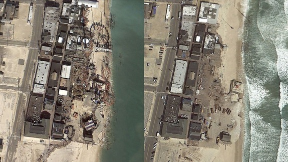

If you’re a Google Earth expert, you’re well aware Google’s rich mapping software features historical data on a number of places around the world
Whenever you see a clock icon, select to view historical imagery from that exact location. You’ll then have the option to use a sliding tool to view the site’s progress through time.
We traveled through [Google] Earth to find some of the most shocking imagery available. If you click through the gallery above, you’ll see the shocking effects of bustling development, natural disasters, explosions and terror attacks. Google Earth has become a digital museum, archiving history through aerial imagery. Read more…
More about Google, Gallery, Google Earth, World, and Photography
Read more : 11 Shocking Google Earth Before-and-After Photos


0 Responses
Stay in touch with the conversation, subscribe to the RSS feed for comments on this post.